Hiking trails near Kimaro
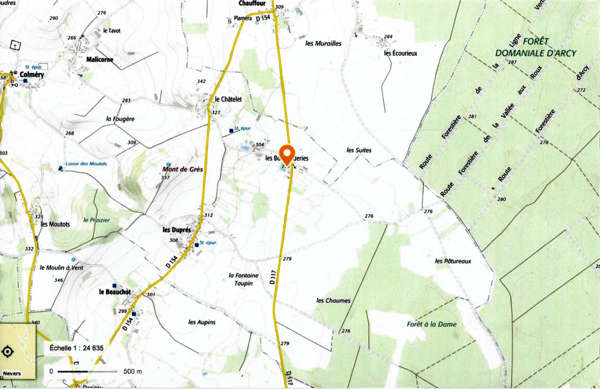
Hiking trails near Donzy
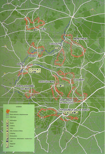
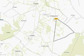
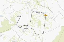
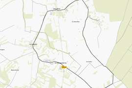
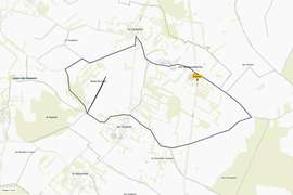
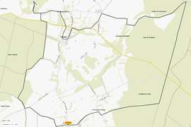
Circuit van Colméry
14 km
Departure : place de l'église (church square) in Colméry
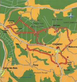
Blue marking
1 - Leave in front of the church, and pass a beautiful washhouse, and continue on the road to the hamlet of Malicorne.
2 - Stay on the road, 100 m after the cross, take the path on your left and continue for more than one kilometer to the hamlet 'les Lacs'.
3 - Stay on the road, turn right, then right again, follow the road and about 100 m after the bank on your left at the entrance to a large driveway, take the path on your left (line no. 8).
4 - Enter the forest (lot 8), the path leads to 'Rumpchat'.
5 - At this forest roundabout, turn right and continue until you reach the road.
6 - Turn left at the road, cross the hamlet `Godards du Haut` and join the D127.
7 - Turn left, then 30 m further left again towards `La Boissonnerie`.
8 - After the 'Boissonnerie' take the straight path leading to 'Rumpchat'.
9 - At the roundabout 'Rumpchat' take the forest lane on the right, this leads back to the D127.
10- Take the D127 on your right for about one kilometer and then turn left towards the hamlet `Paray`.
11- 200 m further on, take a path on your left that leads to the hamlet 'la Cour'.
12- Take the path on the other side, it crosses the D127.
13- Take the path across the street and pass the washhouse of 'La Fontaine-Moutot'.
14- Look for the road again, turn left towards the village of Colméry.
Colméry
The municipality of Colméry covers an area of about 2345 hectares and has almost twenty hamlets.
In the village, the town hall with its XVIth century style, registered in the inventory of historical monuments, the washhouse. In the hamlets of Colméry there are six other washhouses to admire.
The main activity in the municipality is agriculture (cattle breeding and cereals).
The forest covers part of the municipality's territory. The municipality is hilly and has beautiful views, the highest point is `Mont de Grès`, it lies at the watershed of the Seine and the Loire.
Download hiking route here
Hiking tour around Saint-Malo
14,5 km
Departure : church square in Saint-Malo-en-Donziois
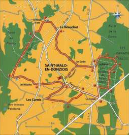
Yellow marking
1 - From Place de L'église, take local road 4, go to the Pillot fountain and cross the D154.
2 - Go in the direction of `Les Métairies`, and continue straight ahead (stone road) until you reach the Palais where you can admire a beautiful panorama, indicated by a sign. Continue straight ahead (do not turn left to join the paved road).
3 - Turn right, follow a path at the beginning along the forest on the edge of the meadow, then enter the Bois du Foulin, until you reach D127.
4 - Turn left, then 100 m further to the right, follow a path that runs along the forest in the direction of the windmill.
5 - At the road turn right, direction 'le Beauchot' (panorama of the windmill).
6 - Continue on the road in the direction of the hamlet 'Les Gardes' and then reach the hamlet 'Les Potiers'.
7 - Cross the D117 and take the right-hand lane opposite the fork in the road, which becomes a dead end further on. Go to the entrance of the forest.
8 - At the entrance of the forest, a grassy path, take it for about 100 m, then take the forest road on the right across the ditch.
9 - At the intersection of plots 26, 27, 28, go straight ahead.
10- At the end of the alley after crossing the stream, turn right, parcel 26.
11- At the intersection (lots 1, 26, 24) take the road to lot 24. Then we cross parcel 22.
12- Take a cave forest path to the left.
13- 50 m before reaching the main road turn right into the forest path.
14- When you reach the D117, turn left.
15- At the intersection with the national road take the D127 directly right in the direction of 'les Pontots'.
16- 200 m after 'les Pontots', take the road to the left that leads to the main road.
17- On the right side, go to the hamlet 'les Carres' and then turn right back to St-Malo-en-Donziois.
Note : After N° 6, in the hamlet 'les Gardes', you can turn right to St-Malo via the small road in front of the cemetery.
Saint-Malo-en-Donziois
131 inhabitants - 1500 hectares.
Saint-Malo was the seat of an important Cistercian abbey founded in Bourras in 1119 by monks from Pontigny Abbey who answered the call of the Lords of Champlemy.
At the time of the Revolution, the monks who lived there were dispersed.
Download hiking route here
Walking in the forest and along the water
6 km - 6,5 km - 8km
Departure : church square Cessy-les-bois
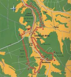
Yellow and blauwe marking
From 1 to 8 : 6 km - Blue marking
From 8- 15-2-1 : 8km - Yellow marking
From 1-2-15-16-17-18-2-1 : 6,5 km
1 - From the church square, take road C1 in the direction of Colméry.
2 - At the crossroads, turn left in the direction of Paray-Colméry.
3 - After the cemetery, take the path on the right, signposted Jaune (yellow) et Blanc (white). Cross the road and enter the forest.
4 - Turn left, and follow it until you reach the road, leaving the yellow and white markings.
5 - Cross the road, take the forest path in front of you.
6 - At the lowest point, leave the forest path and take the first road on the left that goes down.
7 - Take the D187 at the hamlet 'Chevenet', turn left and return to Cessy across the road.
8 - At the entrance of Cessy take the D178, direction Sainte Colombe-Villarnaut.
9 - At the crossroads of the D178-C2 take the D178 and immediately follow the path to the right to the edge of the forest.
10- Turn left, follow the forest, cross the road and take the forest road opposite.
11- Cross the forest road.
12- At the roundabout (crossroads) turn left (parcel 11), follow the road until 'Tresseux'.
13- Cross the hamlet of Tresseux, and go to Bondieuse.
14- Cross the D187, in the direction of the washhouse.
15- 2 possibilities :
a) Go to Cessy via the path along the Talvane on the left side of the washhouse.
b) Go past the wash house, take the path on the right, which goes up and rejoins the road. Take the road on the left.
16- At the intersection of the C6 and the D187 turn left towards Saint Malo and Donziois- les Carrés.
17- Take the path on the left that goes up.
18- At the crossroads of the four roads turn left, pass Montignon and return to Cessy-les-Bois.
Download hiking route here
Châteauneuf-val-de-Bargis
9,5 km - 11,5 km
Departure : Place de la mairie in Châteauneuf-val-de-Bargis
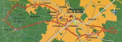
Yellow of blauwe marking
Circuit 1
9,5 km - Yellow marking
1 - From the town hall, turn left at the post office, past the public toilets.
2 - Cross the national road, direction 'Château-la-Tour', yellow and white markings. Follow it.
3 - At the crossroads, leave the markings aside, turn left and cross the main road again. Red and white markings GR654, follow it.
4 - At the crossroads turn left, leave the GR. Take the D2.
5 - At the D2 take the road until 'Chamery'.
6 - At 'Chamery' follow the road from 'Les Cours' to the washhouse, then make a U-turn, return to Chamery, turn right at the crossroads.
7 - Turn right on the RD 140.
8 - Leave the RD 140, turn left into the hamlet `les Riaux`, take the opposite road.
9 - Turn right, pass the Bellevue roundabout, the bridge roundabout, come back via the avenue on the left of the hunters' hut.
10- Take the GR 654, to 'Bellevue', then follow the road to the national road.
11- Cross the national road, take the GR on the other side, pass the cemetery, the football field and return to the town hall.
Circuit 2
11,5 km - Blue marking
1 - From the town hall, turn left at the post office, past the public toilets. Cross the national road, direction 'Château-la-Tour', yellow-white markings.
Follow it. At the crossroads, turn right, still signposted in yellow and white.
2 - In the hamlet 'Pressour', after the washhouse, turn left onto the road. (marking yellow and white)
3 - At the crossroads, turn left, even with yellow and white markings, follow the path to the large roundabout (hunter's hut).
4 - At the big roundabout, take the 3rd road on the right, left of route 89. Follow the yellow and white markings.
5 - On route 91, leave the PR (yellow and white) and turn right.
6 - Take route 81
7 - Turn right into the avenue
8 - At the end of the avenue turn right, and go over the plot 59, and go along the alley to `Mont`.
9 - Turn right at the end, pass parcel 59, follow the road to `Mont`.
10- Cross the 'Mont' and go down the road.
11- Take the road on the right, follow it to the farm of 'Champboyard'.
12- Pass behind the farm and follow the path on the right that leads back to the hamlet 'les Toules', and then back to Châteauneuf-Val-de- Bargis.
Download hiking route here
Hiking route Sainte-Colombe-des Bois
10 km
Departure : parking lot of the church in Sainte Colombe-des-bois
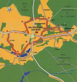
Blue, white and yellow markings
1 - From the church square, take direction Cessy-les-Bois (D 178).
2 - After the cemetery, turn left in the direction of 'Le suchet'.
3 - At the entrance of the forest, take the path on the left until the 'Collet'.
4 - Go down to Fontarabry and continue until the D2.
5 - Cross the D2 (Ste Colombe-Donzy) towards 'les Jamards', pass in front of the hangar.
6 - At the left side go down to the D178.
7 - Turn right for 1 km.
8 - Yellow and white markings. Turn left to the 'ferme des Geais' and follow it to the washhouse of 'Champdoux'.
9 - Do not cross the river, but take the 'chemin du Laitier' on the left (blue markings).
10- At the forest, above the ponds, take the chemin Rouge, on the right.
11- Cross the road D2 (Ste Colombe-Châteauneuf) and continue on the opposite road.
12- Arriving on D178, turn right in the direction of Villarnaut.
13- In Villarnaut turn left on municipal road 1 in the direction of 'le Suchet'.
14- At the crossroads turn left and go down to Ste Colombe.
Download hiking route here
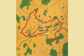
Hiking route around Perroy
12 km - 3 h
Departure : Church of Perroy
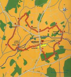
Yellow marking
1 - From the church take the D152 towards Donzy.
2 - At about 200 m from the end of the village, turn left onto the path marked in yellow. Go through the forest, and you arrive on an old Roman road, not asphalted, but of which the two dikes are still clearly visible.
3 - Take it to the left, cross the forest for 600 m to reach an asphalt road.
4 - Turn left on the road, walk about 400 m, then turn right at the crossroads.
5 - At the crossroads go straight on until the 'Domaine de la Garde'.
6 - Pass the 'Château de la Garde' before reaching the old railway line.
7 - Turn left, walk 500 m.
8 - Take the railway on the right, follow it until the D152.
9 - Take the country road leading to the hamlet 'Pauprisé'.
10- Cross the hamlet, and follow the signposted path for 600 m, follow it on the right for 350 m, then on the left for 200 m and again on the left until you reach the asphalted country road of 'Les Tizots'.
11- Turn left, pass the petrol station that supplies Perroy and Donzy and arrive at road D237. Follow it to reach the hamlet of 'les Rabions'.
12- At the crossroads, take the left lane and follow it for about 1.4 km until you reach the old bridge with metal railings, which spans the old railway line.
13- If you cross this bridge and follow the path, you will see the castle of La Motte-Josserand.
14- Return to Perroy by following the path that crosses the stream of the mill no longer in use and then the river Nohain.
Perroy
The origin of this municipality is rather poorly known because its archives were destroyed during the fire in the town hall at the end of the XIXth century.
Only its territory bears witness to its possession by many traces of an occupation dating back to the Iron Age.
During surface investigations, fragments of tile mortar, tile stones and ceramic shards were found. The municipality of Perroy is an oasis of peace. The meadows and marshes give a charm to this municipality which, crossed by the Nohain river, is planted with poplars. The communal woods in which one can walk allow one to recharge the battery in peace and quiet. When you arrive in the village, you can admire the church of Notre Dame (XVth century), as well as the castle of La Motte Josserand, real jewels of the Middle Ages.
Notre Dame, the church of Perroy
This church dates from the 15th century. At the top of the facade is the statue of the Holy Virgin placed there.
In this facade you'll find a gothic door and a small rose decorated with mullions. Inside you can still see some funeral plaques.
The castle of La Motte-Josserand
There was probably an older hill on the site of this castle, built on a rock in the middle of the marshes. It has been rebuilt many times, but it still looks like a fortress.
It consists of four main buildings of different periods; their corner towers, with ramps at the base, are flanked by battlements and pierced with loopholes, some of which were used for firing draw weapons, others for firing firearms. On the eastern portal, the grooves of the drawbridges are still intact.
Download hiking route here
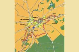
Discover Donzy
11 km - 3 h
Departure : parking lot of the town hall in Donzy
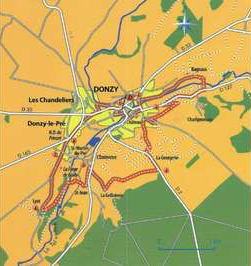
Yellow marking
Weapon of Donzy from 1 to 7
Yellow-white from 7 to 8
Yellow from 8 to 1
1 - Go down the stairs at the end of the square and arrive at rue André-Audinet (moulin de Maupertuis on the left). Take this road to the left. Take rue du Pont-Notre-Dame on the right and cross the bridge of the Tréflilerie. Continue on Rue de l'Etape which turns left, cross the Place du Vieux-Marché and continue on Grande Rue to reach Place Gambetta. Continue to the left through the suburb of Bouhy.
2 - Take the Rue de la Folie, turn right and continue towards Bagnaux. After the farm, turn right, cross the Talvanne river on the footbridge and take the D127 to the right for 700 m in the direction of Donzy.
3 - Just before the village, turn left, in a sharp corner, on the path that goes up. It turns right and joins the old road to Cessy. Follow it on the left, then take the street, de la Chaumette on the right. At the crossroads, turn left onto Chemin de la Georgerie. For this place
4 - Turn right and go to La Grilloterie. After the buildings, turn right at a sharp angle, take a small tarmac road and cross the D1.
5 - At the electricity box, take the dirt road on the left to Saint Jean. Continue to Le Nohain and cross the river. At the old forges of Bailly, cut off the road and take the path to Lyot.
6 - In the hamlet, take the path on the right, then the small road on the right and continue along the road on the right in the direction of Donzy-le-Pré.
7 - Pass by the Saint-Martin-du-Pré chapel and pass the abbey of Notre-Dame-du-Pré.
8 - At the crossroads, take the D163 to the right in the direction of the swimming pool, then rue de la Piscine to the right and rue du Général-Leclerc to the right. Take rue du Point-du-Jour on the left, rue du Commandeur on the right and then rue du Général Leclerc on the right. Return to Place de la Mairie on the left.
Water mill in Donzy
In the middle of the village of Donzy, on the river Nohain, stands one of the last mills of Donziais that survived in its entirety.
The mill of Maupertuis is built on four floors and consists of a part where the wheat becomes flour and a part for the storage of sacks of wheat, flour and bran.
Modernised over the centuries, this mill is very representative of the evolution of the miller's work from the 15th century to the present day. Since a few years, it has housed an ecomuseum of the mill industry. The visit of the ecomuseum makes it possible to discover the full operation of the mill.
Download hiking route here
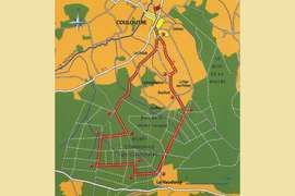
Route of the oak trees
11 km - 3 h
Departure : Church of Couloutree
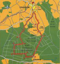
Yellow marking
1 - Go through the village towards `route de Bouillant`, turn left at the crossroads of the `chemin des Louis d'Or`, which opens onto the road.
2 - Turn left and cross the hamlet of Bouillant.
3 - Cross Bouillant, towards the water house along the road.
4 - At the roundabout of Bouillant, turn right and follow the forest road for 1.6 km.
5 - Cross the road, take opposite the forest avenue for 500 m, parcel 28.
6 - Turn right, walk 200 m.
7 - Turn left, plot 30, and walk 900 m, until you reach the road.
8 - Turn right, plot 34, take the road for 700 m.
9 - Leave the road on the right, lot 21, and walk 600 m to the road.
10- Turn left.
11- At the next intersection, turn right and join Couloutre via the municipal road.
Couloutre
Couloutre is 9 km from Donzy, and 20 km from Pouilly-sur-Loire, Giennois and their famous vineyards. Couloutre has a 400 hectares of communal forest that is managed with the help of the `Office Notional des Forets.
Since 1972 it has been equipped with a modern conversion to deciduous forests that guarantees its sustainability.
It is the subject of work of rejuvenation and enrichment in precious tree species, mainly oaks.
A mature oak gives life to thousands of seedlings from acorns that it supplies periodically.
The rapid removal of the seedlings ensures that the young seedlings grow normally in full light.
With the help of the forester, through successive maintenance operations, felling and thinning out, it is 150 years later that the best of them will form a quality forest which, before being exploited, will in turn produce a new generation of oaks.
Building a forest heritage for the future is a long-term investment that will benefit future generations.
Welcoming and productive, that is the objective assigned to this forest. There is already a sports track that allows you to visit the forest, in addition to the pedestrian circuit.
Download hiking route here
Walk Around Ménestreau
19 km
Departure : church square Ménestreau
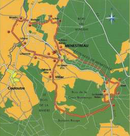
Yellow marking
1 - From the church square, descend to the crossroads of the D117 and take the opposite road towards Pelé.
2 - At about 200 m take a small tarmac road on your right, until you reach the water house. Continue along this straight forest avenue.
3 - At the end, take a right, an asphalted road, and further on take the track on the left towards the place called 'Chenet'.
4 - At the place called 'Chenet' take the path on the right.
5 - 200 m further you turn right, you cross the D117 in the direction of 'Les Grandes Herbes'.
6 - At 'Les Grandes Herbes' you take the path on the left, you follow it, you come back on the D117.
7 - Turn right, 150 m further on, turn right again.
8 - Continue through the forest to reach the valley of the 'cul du loup', then the village of Villiers.
9 - Go straight on, past the castle of Villiers, dating from the Xllth century, and continue in the direction of the farm 'la Maison Rouge', always straight on in the direction of Ménestreau.
10- At the entrance of the village, turn left and follow a road.
11- At the first crossroads, turn left.
12- Second crossing on the right, direction 'La Bonnerie'.
13- Go straight on, cross the D1, pass the farm 'Lativeau', go straight on, 500 m further right.
14- Take a path, then a road, to the village of Nérondes.
15- Cross Nérondes and then cross the D1.
16- Take the railway on the other side and follow it for 1 km.
17- Turn right, cross the place called 'le Pelé'. and get out on the big road.
18- Turn right towards 'Les Petites Maisons' and then back to Ménestreau.
Menestreau
Coming from the direction of the village of Villiers, you will certainly appreciate the nobility of the Xllth century castle and the character of the washhouse.
In Nérondes, the mill, built on the banks of the Nohain river, was in use until 1957; reoccupied, it comes back to life like all the houses of the flour mill. Mallard ducks are bred on the banks of the river Nohain for hunting in the region.
Download hiking route here
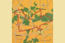
Walk around Ciez
15 km
Departure : place de l'église in Ciez
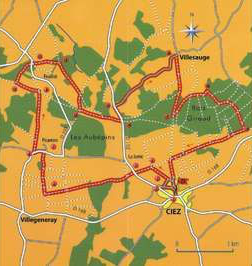
Yellow marking
1 - From the church, cross the D152, along the stream.
2 - At the cross, turn left, then straight on, further on turn right at the sign announcing the stop sign.
3 - Take the stone path on the left.
4 - At the cross turn left.
5 - Cross the D152 and then take the opposite road.
6 - At the second crossroads, turn right and join the hamlet of Picarnon.
7 - Turn left at the road.
8 - Before the crossroads at Perroy, Alligny-Cosne, turn right onto the road and continue straight ahead.
9 - At the crossroads, turn left.
10- At the highest point, at the entry of the forest, turn right.
11- Cross the road, take a path that goes to the other side.
12- At the crossroads, turn right.
13- At the crossroads turn left.
14- When you reach the road, turn left.
15- Turn right, follow the road up to the hamlet of Villesauge via the paved road.
16- At the entrance of the hamlet, turn right, follow the path into the forest.
17- At the crossroads of the four paths, turn left.
18- Turn right, stay on the path.
19- Take a stone road, turn right, further on the road is asphalted, it leads back to Ciez.
Ciez
The parish of Ciez was founded in 1080; the service was provided by the monks of the Chartreuse de Boisjardin, then from 1654 to 1690, by the Brigitain fathers who settled in Le Plessis.
The construction of the church dates back to the early 1500s. It is dedicated to Saint-Martin; on the stained-glass window of one of the chapels, he shares his coat with a poor man at the gates of Amiens.
The second patron saint is St. George; a small stone equestrian statue, placed near the apse, outside, represents him killing the dragon, like the one on the altar of Hagia Triada in Thessaly.
Download hiking route here
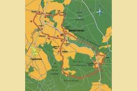
Hiking trails near Varzy
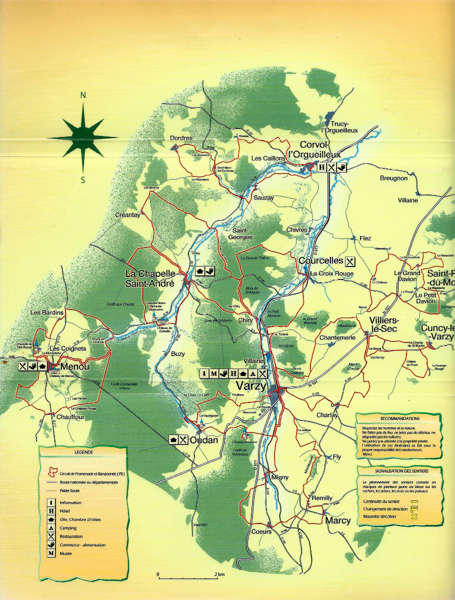
Walking route along the castle of Menou
11 km - 3 uur
Departure : Place de l'Église (church square) in Menou

Yellow marking
Go from the church square around the town hall on the right. Cut off the D33, go straight ahead, pass a well and arrive at La Monarderie.
Turn left, continue for 300 m, turn left and enter D33. Follow it for 50 m in the direction of Menou. Take the first road on the right in the direction of the castle.
Pass the mission cross (on the left, at the end of the alley, admire the facade of the castle). Go straight ahead.
After 400 m, go right up, about 20 m, and turn left (on the left you will discover the massif around Menou). Go along, then enter the Saint-Siméon forest and go down.
Turn left and go up 500 m. Turn left and after 500 m reach the road to Colméry. Turn left and go at 50 m altitude, turn right, arrive on the D154 and take this road in the direction of Chauffeur. (i.e. turn left)
Inside the hamlet, cross the D117, go straight ahead (direction Les Perrets, Les Ecourieux), pass the pond and arrive at Le Chapeau Rouge.
At the crossroads, turn right for 50 m and then left around the pheasantry. Follow the forest road for about 1.2 km and you will arrive at a store for forest products. Cross it diagonally, then turn left onto the stone track and continue on to D33. Cross it to reach the line opposite the crossroads.
Pass the 'Roland' hunting lodge and arrive at a new roundabout to take the leftmost path.
Follow the path that goes up the valley on a gentle slope until you reach the cemetery. Follow it to the left, cross the D19, go straight ahead and pass in front of the washhouse. At the crossroads, turn left, cross the D33, continue in the direction of the castle and you will reach the 'place de l'Eglise.'
Château de Menou: (private property, no visit): often referred to as the 'Versailles of the Nivernais', it was built between 1672 and 1684. Its architecture reflects the traditional order of the XVth century.
Download Hiking route here
Hiking route de la Chapelle de Tête Ronde
10 km - 3 uur
Departure : Church Square Menou

Blue marking
From the Place de l'Église turn left on the D117.
Pass the weighbridge (right), the presbytery well (left) and follow direction D33.
At the intersection of the D33 and the D19 take direction La Chapelle - Corvol-l'Orgueilleux.
Take the first road on the right to the cemetery. Follow the wall and after the cemetery, take the dirt road opposite which leads to the forest. The path goes down, turn left at right angles.
Then go along the wood on the right side. Continue until the first path on the left, take the path that descends 500 m and discover the source of Touffoux on the left. Go straight ahead along the forest.
At the Chappe reservoir turn left towards the D19. Pass the embankment of this old pond and discover the ruins of the Chappe mill on your right.
Before the engraved stone arrives, turn left on the D19 for 100 m (direction Menou). Take the dirt road on the right, then 20 m further on the left. Go along the forest and let the path go up to the right.
Keep going along the forest and then go into the forest. Walk 300 m and take the path to the left. After 200 m follow it at the right side and you'll reach the D117.
RAt your right there is a cross and a bench. Turn left onto the D117 in the direction of Les Bardins. In the hamlet, take the first road on the right (opposite the well).
Follow the path that goes up and turn left, leaving the wooden cross on your right. At the pole, take the left path, pass a pump and go up the stone path.
Continue for about 600 m, leave the first path on the right and take the second dirt track on the right (opposite the metal shed downstairs on the left).
Go up, pass the forest on the left side, enter the forest, follow the path on the left side. Go straight ahead and at the end of the path go over to the left. Go straight ahead until you reach the chapel the Tête Round.
Go back down and take the D511 in the direction of Menou. At the intersection follow the stone path.
At Monarderie, turn right onto the D33. Cross the road and reach the Place de l'Eglise.
The chapel Notre-Dame-de-Tête Ronde :
This chapel, placed on the top of the hill of Tête Ronde (one of the highest points in the region) was built between 1872 and 1875, according to a vow of the inhabitants who promised its construction if the Prussian invaders of France would spare their village. Inside, the famous poster artist Charles Loupot (1892 - 1962) painted a series of frescoes recalling the existence of the Virgin Mary.
The source of Touffoux :
It is also called the 'source of Chappe'. For a long time, the inhabitants of the region came to fetch the water, which is very weakly mineralized and renowned for its quality. Touffoux was a hamlet, today it has disappeared.
Download Hiking route here
Walking route Washhouses (Les Lavoirs)
12 km - 3 h 30
Departure : place de la Mairie (town hall square) in La Chapelle-Saint-André

Green marking
From the Place de la Mairie, turn right for 75 m, cross the Sauzay bridge on the left, pass the washhouse on the right and you will reach the D19 (route de Corvol-l'Orgueilleux).
Follow it to the right for about 120 m and at the crossroads turn left onto the D5.(Direction Entrains-sur-Nohain).
Arriving at the Monument aux Morts, turn right along the cemetery, taking the road towards Les Berthes - Créantay. Walk about 400 m and, at the level of the cross, take the path on the left.
80 m further on, at the level of the pole, go straight on and enter the forest. Continue on to the first intersection, and then turn right and then right again. Walk along the edge of the communal forest and see the first houses of Créantay.
Leave the cross on the right, arrive at the crossroads, take the first road on the left (at the sign Créantay) and go straight down into the hamlet.
At the crossroads, take the direction Les Berthes - Corvol and go up.
Walk past the washhouse on the right and come at the crossroads. Go straight on and enter the hamlet Les Berthes.
Go straight on and turn right. When you arrive at the last houses, take the first unpaved road to the right next to the water tower/ water house. Enter the forest, leave the hunting lodge at your left.
After about 1.8 km take the path in the middle of the fields and go straight down to the valley.
Cross the forest again to reach the D19 (road to Corvol-l'Orgueilleux).
Turn left for 10 m and take the path on the right. Pass the hedge, between the poplars, go along the Sauzay (river) for 10 m and cross it using the poles (note the foundations of an old bridge).
Walk along the river again and go straight up the path. Reach a wider path and continue uphill to the left.
At the next intersection go straight on via the 'chemin des meuniers'. Continue straight on until the D185 (direction La Chapelle - Courcelles) and arrive at the sign 'Forêt communale de Varzy'.
Turn left on the D185 about 220 m and take the first road on the right.
Enter the forest of Bourse Longue, follow the forest road for 600 m and reach a large clearing. The 'Sur Chiry' farm appears on the right.
Cross the clearing, follow the steep path into a wooded area and reach the road to Sur Chiry. Go to the right and leave the Sur Chiry farm on the right side.
Go straight ahead and enter the forest. At the intersection with the Croix-du-Cerf road turn right and descend to La Chapelle Saint-André (panoramic view).
At the first intersection go straight on, cross the Vernet bridge and continue. Continue straight on until the first street on the left leading to the town hall (La Mairie).
Download Hiking route here
Walking route of Corbelin
12 km - 3 uur
Departure : Place de la Mairie (town hall square) in La Chapelle Saint-André

Yellow marking
From the Place de la Mairie, turn right for 75 m, cross the Sauzay bridge on the left, pass the washhouse on the right and you will reach the D19 (route de Corvol-l'Orgueilleux).
Follow it for about 120 m and at the crossroads turn left onto the D5 (direction Entrains sur-Nohain).
Arriving at the Monument aux Morts, turn right along the cemetery by taking the municipal road (chemin communale) towards Les Berthes - Creantay. Walk about 400 m and at the cross take the left path for 80 m.
At the pole, go straight on, enter the forest and continue until the first crossroads. Turn left on the road 'Crô de la Charbonnière'.
Walk about 400 m and pass in front of the pond of the Crô de la Charbonnière (located on the left), then 100 m further on in front of the hunting lodge that can be used by hikers. 400 m further at the crossroads turn left on the D5 (route d'Entrains-sur-Nohain).
Walk along this road for about 150 m and take the forest line on the right. Walk 300 m and take the left path, continue for 250 m and reach the moat.
Go straight ahead along the separating moat for 80 m, take the ditch on the right side.
Continue following it down for 350 m. Turn right to get to the edge of the forest.
Walk 200 m, turn left into a path, follow it straight down. Walk 1.5 km and come to the D19 (road from Corvol-l'Orgueilleux to Menou).
Take the D19 on the left, pass in front of the chapel of Corbelin (on the left), then take the path on the right which is laid out on the embankment of the old pond of Corbelin.
The castle of Corbelin is on the left. Turn right, go along the back of the castle to reach the bridge over the Sauzay.
At the intersection with the D155 turn left. Follow the D155. Go past the Vernet spring (on the right), then past the ballroom - Salle des Fêtes (on the left).
At the intersection with the D5 go straight on until you reach the yellow bridge. Turn left and return to the Place de la Mairie.
The Chapel of Corbelin : Dedicated to Notre-Dame-de-September, served a parish that has now partially disappeared. In the 13th century, the site was the site of iron and steel activity, which led to the creation of a parish that lasted until 1800. The chapel became an agricultural building and was restored by CAMOSKINE in 1995 and 1998.
DThe Crô (natural hole filled with water) and the Charbonnière pond : They perpetuate the memory of the coal people, very numerous in the municipality. For centuries, charcoal made in the forest was used as fuel for the Corbelin blast furnace. The location of the furnaces where the charcoal was transformed into charcoal is still clearly visible in the forest. The earth remains very black and the vegetation is rare in the areas dedicated to this activity.
Download Hiking route here
Varzy Forest Circuit - Oudan - Varzy
9 km - 3 h
Departure : place des Promenades in Varzy

Yellow marking
From the 'Place des Promenades', opposite the 'Hotel Logis de France', turn right and head towards Parigny-la-Rose. At the Varzy exit, after the sign, turn right and follow the road until the 2nd crossroads.
Turn right and follow the track. At the end, at the level of the railway crossing, turn right onto the road, cross it and take a path that leads straight to the chapel of Saint-Lazare.
At the chapel, turn right, then right again 50 metres further on. Follow the path for 200 m and then turn left. The path rises into the forest and leads to the road. Opposite there is a pizzeria. Cross the road and at 500 m take the stone path on the other side (old Gallo-Roman road). Turn left and arrive at the village of Oudan.
In Oudan turn right past the washhouse and then right up to the church.
Turn left and go (descending) to the left, then to the right on the road to the 'l'étang du flottage'. Go around the pond and come back at the same point. Take the road on the other side, the road goes up to the entrance of the village. Take the path to your left and go up into the forest. Enter the forest, turn right and follow the path until you reach a forest path. Turn right, follow the path for 1 km, pass 2 paths on your right, at the 3rd exit to the right.
Go down through the forest (sunken path), then the path leads to a road. Turn right. 200 m further left and then 100 m further right.
Follow the path until you reach the road. Cross the road, go straight ahead and go down to Varzy. Go under the railroad bridge, go left, then right, go to the square Sainte-Eugénie.
At the washhouse, go under the roof of the washhouse. Get in front of the church and join the Promenades.
The Saint-Lazarre chapel, from the 12th century :
Location of the old Vaumorin leprosarium, installed after the crusades to keep away the lepers, this chapel was assigned to the monks of Montjou (Alps) who cared for the sick and worked the cleared land. With the disappearance of the leprosy, it was abandoned in 1696 under Louis XIV, who demanded the preservation of the cult buildings. The wooden buildings disappeared; the leprosarium was moved to the Hôtel-Dieu in Varzy. A new clock, dating from 1863, was left behind for a long time. The chapel was restored between 1977 and 1982.
Download Hiking route here
Walking circuit of the washhouses
Varzy - Migny - Coeurs - Marcy - Fly - Varzy
15 km - 4 h
Departure : place des Promenades

Green marking
From the 'Place des Grandes Promenades', turn right and head towards Parigny-la-Rose. When leaving Varzy, after the sign, turn right and follow the path to the 2nd intersection. Turn right and follow the railway (built between 1870 and 1877) until you reach the level crossing. Turn left, then 50 m further to the right and continue straight ahead. At the end turn right to reach Migny.
In Migny, past the level crossing and 25 m further, turn left. 100 m further, take the path on the right that joins the road. Turn left, go through the hamlet, go straight on and then take the path on the right for the signboard of the hamlet. Follow it, cross the D977 and take the opposite path that goes up in the forest: it joins the departmental road. Cross it and take the D186 on the other side. At the crossroads, take the opposite road in the direction of the washhouse. At the crossroads, continue to the other side and then turn left. Follow this road: it goes under the railway bridge. Follow it until you reach the road, turn right, cross it and go straight ahead. Cross a second road, go straight on. At the fork in the road, turn left onto the path (on the left the old school of Marcy, and on the right the castle of Trinay). At the crossroads, turn left and you will arrive in Marcy. At the stop sign you go straight on, cross the road and go straight down. You pass a pigeon loft (square tower), then turn left for the washhouse and follow the road to Rémilly.
In Rémilly, turn right in the direction of the washhouse, and at the crossroads of the D102, turn right again until the end of the village. Turn left and go up the road (uphill). At the crossroads, take the paved road to the right for 200 m, then turn right again.
Walk past the reservoir, then turn left and follow the path down towards the hamlet of Fly.
In Fly, turn left, then straight on. At the second intersection, turn right in the direction of 'de la Justice'. Go straight ahead, and you'll come to the paved avenue. Turn left and go back to Varzy.
Download Hiking route here
Hiking route of Villiers-le-Sec
Varzy - Villiers-le-Sec - Varzy
13 km - 3 h 15
Departure : place des Promenades

Yellow and Green marking
From the 'Place des Promenades' take the direction of Clamecy and the museum. Cross the courtyard of the Town Hall and take the exit on the other side. Go to the right and then to the left. Take the road to Clamecy by going to the right. 100 m further turn right in the direction of Beuvron.
At the end of the village of Varzy, after the sign, take the 2nd road on the right (about 500 m after the cemetery), go straight ahead and then take the 1st road on the left, which joins the road.
On the road, turn right, then 200 m further, through the many bends, turn left until Charlay. In Charlay, turn left and continue straight on for 300 m. Turn left.
At the crossroads, turn right, then right again. Go down the path and after the walnut trees turn left (opposite in the valley, you have a lovely view of Vesvres). Follow the path, pass a vineyard, then walnut trees, to join the road. Turn right and take the road to Villiers-le-Sec after I km. Pass by the pond, take the opposite direction to Neuzy. At the bottom of the forest, take the road on the left (opposite the castle of Saint-Pierre-du-Mont). After the pine forest, take the path on the right for 100 m. Turn left opposite the statue of the Sacred Heart (du Sacré-Coeur).
Follow this path, which connects to the road (with a cross). Continue along the path between the fields and then turn left to reconnect to the road. Turn right, then right again and take the path that goes up to Sacré-Coeur.
Return to the stadium, then to Les Promenades, past the statue of the deportees (realized by the pupils of the LEP of Varzy).
Download Hiking route here
Varzy - Courcelles
14 km - 3 h 30
Departure : place des Promenades in Varzy

Yellow and Blue marking
From the Place des Promenades you cross the city to the stadium. Before the Varzy exit sign, turn left and cross the small bridge. Turn right, walk along the pond and pass the dike. At the end take the path that goes to the right. Follow it to the road.
On the road turn left, pass the level crossing and take the path on the right. Follow it to the hamlet of Chiry. In Chiry, turn left onto the road and take the first path to the right that goes up into the forest. Follow it to the entrance of the field. Turn left and go along the field. On the other side the path goes back into the forest and then joins the road.
Turn right and take the path on the left 300 m further on: it joins a forest road. Turn right, then 20 m further left.
At the end turn right and go straight on for about 1 km. The path leads to a field. Turn right. Follow it to the asphalt road, turn right and follow the road back to Courcelles.
In Courcelles, go straight on, cross the departmental road, then turn right before the railway bridge and follow straight on until La Croix Rouge (the red cross). At La Croix Rouge go straight on, the road goes up to the path between the 2 hills and then goes down to join a road.
On the road, turn left for 200 m and then left again for 150 m. Turn right and follow it to the entrance of Varzy (at the old Viking restaurant). Go across the street, past the stadium, and reach the Place des Promenades.
Download Hiking route here
Abbey walk
11 km - 2h 30
Departure : Corvol l'Orgueilleux

Blue marking
Departure from the church square. Pass in front of the Town Hall and enter the 'Rue Jules Bègue'. Turn right into the main street (D19). Walk 50 m and turn left into the main street of Saint-Maurice.
At the sign indicating this last street, take the street 'Derrière les Murs'. Pass an old water pump and come at the end of this street. Follow the rue de la Ragonnerie and then turn left on the dirt road parallel to the D19.
At the sign on the D143 which marks the end of Les Caillons, take the stone path on your right. Pass the high wall of the former shooting range of Les Caillons and then continue up the path.
Turn left 50 m before the dead-end street to the left. The dirt track goes first right and then left and connects to the D143. Follow it to the right for 500 m (direction Roussy) before turning left for 750 m to reach this hamlet - enter Roussy - after the second house on the left take the left lane. After 300 m, at the first crossroads, continue on the left, go up for 300 m and turn right towards the corner of the forest.
First the road rises, then descends again, for 900 m and reaches Saint-Marc-Les-Fontenay. Walk 15m on the D155, turn left at the level of the houses and go along the wall of the former abbey of Saint-Marc.
Turn right to join the D155. Turn left onto the D155 and continue for 1.6 km to reach the junction with the D19. Walk 20 m, cross the D19 at the cross and head towards Saint-Georges. Take the bridge over the Sauzay river, then the bridge over the water branch of the mill (on the left).
At the crossroads, turn left and walk past the houses of the 'Petit Sauzay' (admire a remarkable dovecote at the next crossroads). Go up by taking the paved road on your left. Walk 100 m to go straight on by taking the dirt track on the left. Go straight on and go down in the direction of Corvol-l'Orgueilleux.
At the crossroads before 'Les Caillons' turn right and go up to Corvol-l'Orgueilleux. On your left you will see the chimney of the old paper mill (which was in operation from 1820 to 1971. The first paper machine that was introduced in France).
At the crossroads with the road to Chivres, turn left, cross the two bridges over the Sauzay and reach the Place de l'Eglise.
Download Hiking route here
Circuit of the hamlets
4 km - 1 h
Departure : Saint-Marc-Les-Fontenay

Yellow marking
Reach Saint-Marc-Les-Fontenay on the D155. The bell tower that can be seen in the heart of the small hamlet is that of an old Romanesque chapel.
Go in the direction of Etais. Take the D155. Shortly after leaving the hamlet, turn left (direction Les Baudions) on the road. On your right, at the bottom of the valley, the Les Baudions petrol station appears.
Enter Les Baudions, leave the road on the right and continue in the direction of Dordres.
At the entrance to the hamlet, at the fork in the road, turn left. Go to Dordres. At the intersection, turn left in the direction of La Pétarderie. Walk past the bus shelter on the right. Go straight ahead and reach the water tower on the left.
Go to La Pétarderie. At the intersection, turn left onto the unpaved road. Leave the track at the right side and go straight down until the junction with the D155.
Turn left and return to Saint-Marc-Les Fontenay.
Download Hiking route here
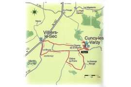
Circuit of Vertenay
9 km - 2 h 30
Departure : place de l'Église (church square) in Cuncy-les-Varzy
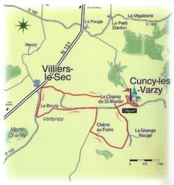
Blue marking
Leave behind the war memorial, walk along the side of the church. Pass the edge of the well, turn to the left. Continue for 200 m.
After the stable (at the left side) and the shed (at the right side) go to the left. At the first intersection go straight ahead. At the second intersection, turn left and continue uphill. Reach the D6 and turn right (direction Villiers-le-Sec).
Continue for 500 m and at the sign for Villiers-le-Sec turn left (on your right you will see the town hall built after 1859. Nearby there was a chapel built in 1712 and destroyed in 1902).
Continue to the right and you will reach the pond of Villiers-le-Sec. Go around it (on the right you will see a cross and the war memorial of Villiers-le-Sec). Go between the bank and the decoration vases, turn left. At the sign 'sortie de Villiers-le-Sec' turn left and take the D102.
Go through 'le Bourg', formerly called 'Bourg de Vertenay'. Go past the cross (on the left) and 50 m after leaving the D102 to take the path that goes down on the left. This road leads to Vertenay, a hamlet that has been abandoned since the beginning of the 20th century. On the left, the ruins of an old agricultural building appear. On the right, the remains of a cross and a washhouse.
Continue for 500 m, turn left and then right to reach the D6 (direction Cuncy-les-Varzy). Continue for 600 m and turn right (direction Chêne-au-Franc, Vesvres).
Reach the bus shelter and turn left at the cross towards the houses. Pass the washhouse and reach the pond of Chêne-au-Franc. Go around at the right side and leave the houses at the left side.
Go straight on for 600 m (notice the impressive oak trees along the path). Turn left at a right angle and join the D186.
Turn left and continue to Cuncy les-Varzy (at the entrance of the village, on the right, you'll find the building of the former presbytery that became the village house).
Go to the town hall school and turn right onto the D6 (direction Tannay-Thurigny). Pass the pond and continue on the D6. Before the sign announcing the exit of Cuncy les-Varzy, take the first road on the left..
Before the well and the bus shelter, take the road down on the left. Walk along the impressive arched wall and turn right (towards the cemetery).
After 15 m discover the washhouse on the left. Go back, turn right and descend. Pass the pond at the right side.
Turn right on the D6 (direction Villiers-le-Sec) and arrive in front of the war memorial and the church.
Vertenay : From this hamlet of Cuncy -les-Varzy, with 15 inhabitants in 1859, only a washhouse, the foot of a cross, a pond and the ruins of a barn remain. In Vertenay there was an old road called 'chemin de troupes' which was walked by the pilgrims of Santiago de Compostela.
Download Hiking route here
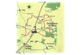
Hiking route of Saint-Pierre-du-Mont
11 km - 2 h 30
Departure : La Pouge, near the town hall on the N151
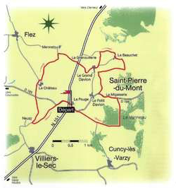
Yellow marking
From the parking lot of the town hall go to the courtyard of the town hall school, take the right gate and follow the N151 along the wall of the school.
At the crossroads, cross the N151 and take the D185 (direction Courcelles). After 400 m take the dirt road on the left and follow it until the entrance of Neuzy.
Turn right onto the path and continue for about 900 m. Cross the D185 and go to the castle. Admire the panoramic view on the left (valleys of the Sainte Eugénie and Sauzay).
Pass by the property of the castle and turn left on a dirt track between two chestnut trees.
After a one-kilometre descent, turn right before entering Mennetou. After 500 m cross the N151 at La Grenouillerie (Note: very busy road).
Continue straight on until Grand Davion. At the end of the hamlet, take the dirt road on the left, follow it for 400 m and then turn right to reach Beauchet.
Go along the drinking trough on the left, then 200 m further, turn right and continue along the forest on the right. After 750 m, before reaching the Grand Davion, turn left.
Walk through Migaiserie, pass the pond and 200 m further turn right.
GGo straight through the forest 'Le Vanneau'. At the end of the forest, turn right for 800 m.
At the crossroads with the road to Cuncy-les-Varzy, turn right towards La Pouge.
Download Hiking route here
Hiking route panorama du Bec d'Allier
Panorama du Bec d`Allier Nature Reserve, hiking route
Route du Panorama
Marzy
N 46°57.495 - E 3°04.558
53 min - 70,4 km

At the junction of the Loire and the Allier rivers, there is a wild and protected nature reserve with glorious views.
This beautiful, rich heritage is just waiting for you to discover it, via its many hiking trails.
Download hiking route here
